

 WRA Whangamata Rate Payers Association
 Whangamata Stormwater Action Group WSAG (2023) Folder
 20230427 WRSAG Flood group precirculation TCDC Flood Letter Warning on property files and LIM 20241016 Folder 20230800 TCDC Whangamata Model Build and System Performance HAL Report Flood Modelling 20241112 LGOIMA information request TCDC HAL Flood mapping report 20240806 TCDC Whangamata Flood Modelling Communication Plan - 6th Aug-24 2015 Asia Pacific Stormwater Conference Tauranga Council release flood letters 20241029 LGOIMA TCDC Stormwater Workshops 20241126 LGOIMA request WRC flood modelling_WRC reply 20241016 Len Salt Mayor emails stormwater 202308 HAL Whangamata model build system performance 2010 NIWA MfE best practice guide preparing-for-future-flooding 2015 Valuer Report Effect-of-Flood-Hazard-notation-on-property 20180515 HAL Williamson Road and Golf Course SW assessment 20241112 LGOIMA TCDC HAL Flood mapping report response and comment NetworkIssuesRFS 20190617 WSP-OPUS Design SW Duplication Williamson Park Undated Whangamata-ModelBuildandSPA_Review_v1.0 20230800 HAL Colour Whangamata Model Build and SPA Report_FINALDraftv2 Contents of Whangamata Flood Letter, flood models and handouts Folder 003 Accompanying Stormwater Flood Model Map Fact Sheet 1
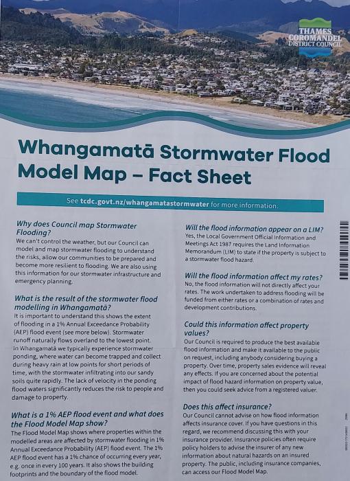 107 Flood Model velocity in m/sec
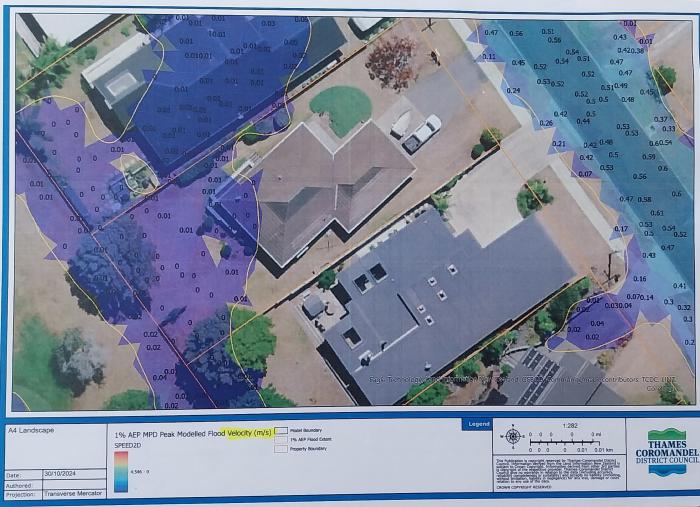 202 Reduce the effects of flooding on my property 2 TCDC
 201 Reduce the effects of flooding on my property TCDC
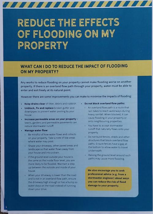 105 Flood Model flood depth in meters
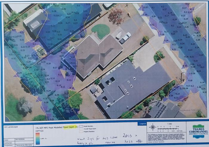 109 Flood Model disclaimer not accurate or reliable
 001 Fllod letter to 5000 ratepayers on 16 October 2024
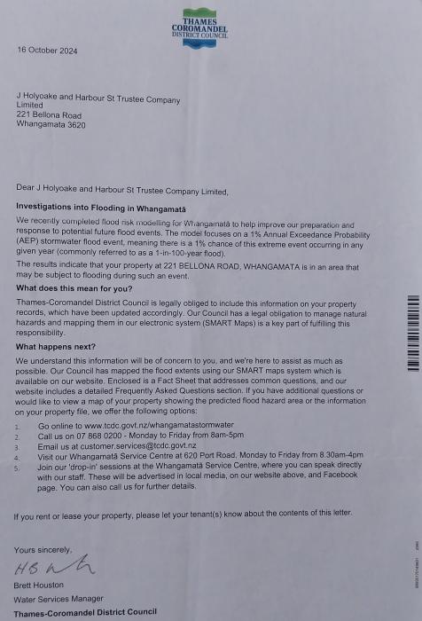 004 Accompanying Stormwater Flood Model Map Fact Sheet 1
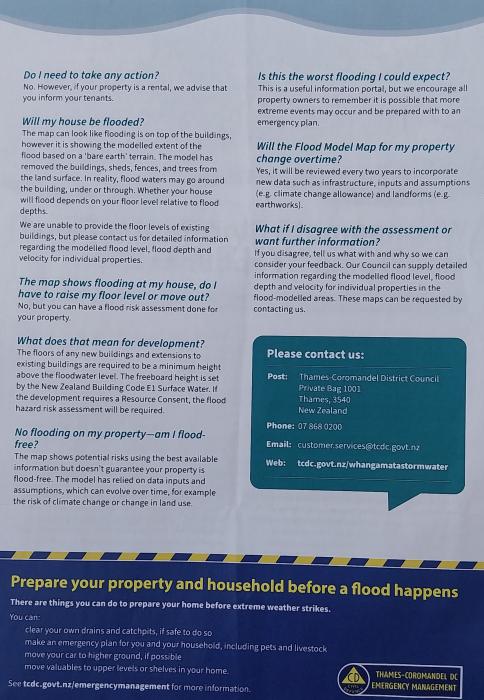 101 Flood Model Peak level to AVD 1946
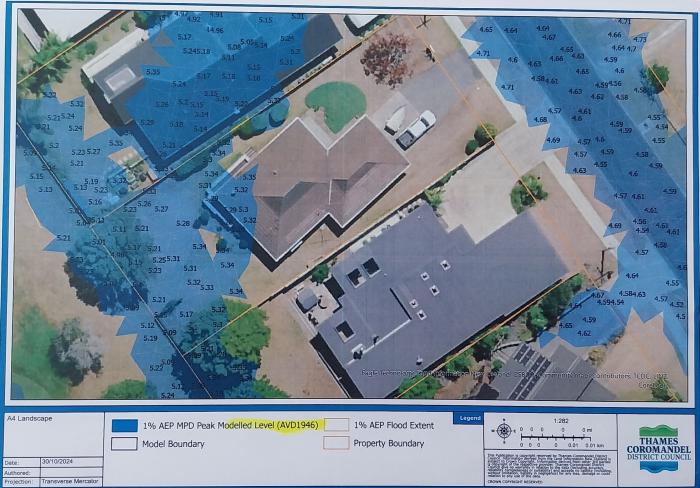 TCDC District Plan s453 Floor levels 20241220 WRSAG letter to public attendees 20121215 Minutes taken at WRA Public meeting Whanga Lounge Official Information Requests LGOIMA Stormwater Folder 2023 LGOIMA TCDC Stormwater Resource Consent 105667 and Williamson Pond Folder 2021 WRC Final site compliance report July 2019 to June 2020 2020 TCDC Annual Report CSDC all areas 2020-2021 20230403 LGOIMA WRC request for resource consent 2011 TCDC Stormwater Consent Evaluation Report CSDC applications all areas 2023 LGOIMA request WRC about Williamson pond 2020 undated TCDC Stormwater Management Devices Register 2022 4SIGHT May Stormwater Monitoring Programme Review of CSDC 2015 TCDC Stormwater Asset Management Plan 2015 Draft Dec 2014 2018 Veolia Municipal Stormwater Network Operation Annual Report 2018 Veolia Stormwater Monitoring Programme with Kessels Ecological Report Whangamata 2020 CSDC Annual Report 2021-2022 by TCDC 2013 Whangamata Stormwater Management Plan Urban Areas Nov 2013 Monitoring 2013 Whangamata Stormwater Management Plan TCDC Urban Area November 2013 A7 2022 4SIGHT June Stormwater Monitoring Programme v1.0 including appendix 2013 KTB Planning Stormwater Management Plan incl Kessels Nov 2013 2018 TCDC CSDC Annual Report Final - site compliance report 2018 to 2020 2023 LGOIMA TCDC soak pit maintenance log Folder Mapped Soak Pits - Whangamata RAMMWhangamata GridExport_Dispatch Insp RAMMWhangamata_GridExport_Drainage 2023 LGOIMA TCDC Response Soakpits Whangamata AssestFinderWhangamata Stormwater_Plant - Soakage RAMMWhangamata Drainage assets AtoZ RAMMWhangamata GridExport_Dispatch InspCall Centre RAMMWhangamata Catchpit Call Centre AtoZ RAMMWhangamata Catchpit blocked Kiwi 2023 LGOIMA TCDC Building Consents issued Folder LGOIMA - Building Consents Issued since 1992 20230315 Whangamata building consents issued 20230306 LGOIMA TCDC Independant Engineer appointed Lincoln and Williamson pipe upgrade Folder 20230307 LGOIMA TCDC independent engineer Undated Whangamata Stormwater Project - Terms of Reference Engineer 20230307 LGOIMA TCDC engagement consultation process lead to invitation 20120900 NZTA Techical review of roading within TCDC 20230418 WRSAG to the Community Board flood meet questions 20160630 MBIE Audit of TCDC 20040500 Stuart Ryan Legal-liability-for-water-escape-and-what-you-can-do-to-avoid-it 20131000 TCDC code of practice stormwater and land design section 6 includes soakage 20230307 WRA Special report presentation public meeting 20230000 Whangamata drainage plan 19920700 Building Code E1 house height above water 20091116 RISA Report NZ Transport IRTAD Seoul 19910000 Building Act s36 notices 20131100 TCDC 16B soak pits and water tables TCDC 20131100 TCDC 16A on-site-stormwater-dispersal-design-e1vm1 20100000 Archived e1-surface-water-amendment-7 20121000 MBIE Guidelines-for-artificial-lakes 20210600 to 2031 TCDC Stormwater CAPEX includes Whangamata Long Term Plan 20131100 TCDC Council policy road construction development design 20230221 Mayor Len Salt future for local government TCDC submission 2023 Island View Carpark Design Community Engagement 2022 to 2023 Whangamata Community Board Capex work annual plan 2020 TCDC significance community engagement policy 20240223 Metis Drybasin WilliamsonPondMemo_WRC_v1.0 20250715 LGOIMA TCDC Whangamata Stormwater Master Plan Requests and Metis Website Folder 1. Whangamata Stormwater Catchment Management Study – Updated Issues and Options Report, Draft – Version 2, Opus, Sep 2005 0. Document Index 4. R Whangamata Stormwater Master Plan – Proposal, HAL - Morphum Environmental, Nov 2018 2. Whangamata Model Build and SPA Report - Rev3 5. Whangamata SMP Strategic Context and Risks, Draft Report 2019 Morphum 8. Whangamata SW Model Build - Data Anomaly Report- Water Engineering Consultants, Aug 2006 9. Otahu Road stormwater catchment upgrade, Project Completion Reports, Thames Civil Engineering Ltd, Aug 2012 2019 Master Plan documents Folder IMG_3868
 IMG_3870
 IMG_3867
 IMG_3871
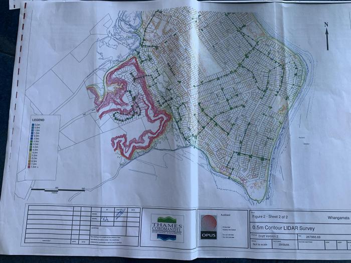 IMG_3869
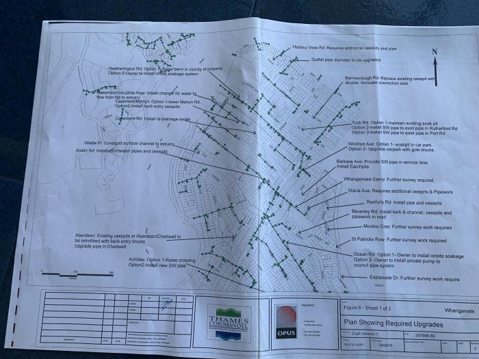 20190409 Whangamata Stormwater Master Plan Update - 5845906 20131100 Whangamata Urban Stormwater Management Plan TCDC Urban Area A7 2018 TCDC CSDC Annual Report Final - site compliance report 2018 to 2020(2) 2025 Metis website Master Plan references Folder 20250213 Metis website stormwater Whangamata 20210000 Metis website content
 20250213 Metis website Whanga master plan content
 20210000 Metis website content2
 20241000 Metis Web Whanga content loaded
 20250213 Metis website Whanga master plan
 20250717_012612 _SC_
 20250717_012706 _SC_
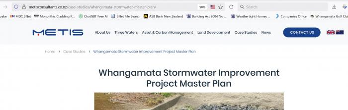 20250717_012542 _SC_
 20250717 Download Metis website Whangamata stormwater 7. Williamson Road Stormwater Assessment, HAL Memorandum, 9 May 2018(2) 6. WSPOPUS 2019 TCDC Williamson Park Whangamata, Stormwater Outlet Duplication Project, Design Drawings, WSPOPUS, June 2019(2) 3. Whangamata Model Build and SPA Report_FINAL 31082023(2) 20250715 LGOIMA TCDC outcomes from CE response to complaint Folder Whangamata_Stakeholder Meeting 20250221 20250715 LGOIMA following CE response 2025 Whangamata SW Improvement Master Plan 082025 2025 CSDC SMP_30072025 High flood risk_Casement and Mako SW drains High flood risk_central whangamata High flood risk_Apperley and Linton High flood risk_ Rangi and Tangaroa High flood risk_ Sylvia and Esplanade High flood risk_Mooloo, Diane, Ranfurly, St Pats High flood risk_ Pipi and Seaview High flood risk_ Tuck and Hunt Rd High flood risk_Lincoln, Chartwell Ave High flood risk_central north whangamata High flood risk_Exeter and Leander Project Request Form Template PPMF Template - Project Steering Group - Terms of Reference TCDC PROCUREMENT PLAN template PPMF Template - Project Roles and Responsibilities Report Template PPMF Template - Project Change Request Monthly Project Report News about stormwater flooding in Whangamata Folder Library: Stormwater Working Group 2023 Folder 2017 Opus Williamson Park Pond Assessment Report Whangamata 2012 Opus Groundwater Monitoring report Whangamata water tables 2005 Opus Stormwater Catchment Management Plan CMP Whangamata Williamson pond report by Eric 20230531_085925 _SC_
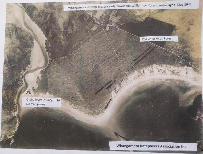 WRSAG Stormwater working group reports released Folder 20230409 WRSAG Public Meeting Stormwater Background and Resolutions V3 20230407 WRSAG Stormwater Group Flooding Report 1 Summary V6.1 20230405 WRSAG Stormwater Group Flooding Report 1 V6 20230529 WRSAG Stormwater Group Flooding Report 2 Summary 20230516 TCDC Whangamata Stormwater Group Action Plan meeting outcomes 20230430 WRSAG follow up TCDC Stormwater Working Group meeting outcomes 20230421 WRSAG Stormwater Working Group Precirculation for TCDC Working Group 20240604 WRSAG Request to Community Board Formal appointment of stakeholders representatives 20240226 WSAG Workshop Stormwater Group engagement proposal 20240528 WRSAG Stormwater Action Group update Williamson Wetland and 20240527 WRSAG selected LGOIMA email response community involved Wetland and Drybasin WRC 20240524 WRC LGOIMA Response REQ208325 Williamson Pond 20240423 WRSAG Complaint to our elected members wetland decision 20240422 WRSAG Draft Open letter to CEO TCDC Stormwater (not sent but discussed) 20240408 WRSAG LTP submission final 20230613 WRSAG (Kiwi Rd) To Honourable Len Salt Mayor Kiwi Rd Issues 20230319 WRSAG 29 Issues and Solutions Flood response 20230523 WRSAG Stormwater Group Flood Report 2 v2 20240415 WRSAG Mooloo Crescent Flooding 20240411 WRSAG Email trail workshops WRC letter wetland to LGOIMA 20230430 Emails WRSAG and TCDC stakeholders meeting master plan 20240320 WRSAG Williamson Park Pond Stormwater Detention Basin Alternate Design (2) 20231211 WSAG Ians meeting notes following workshop 20240716 WRSAG presentation CB Independent commissioner Stormwater Group proposal 20231122 WSAG Proposed DrainMOD modified drainage and recharge stormwater system for Whangamata Holocene Sands 20240701 WRSAG Williamson Drybasin progress report Rain event and comments 20240404 WRSAG Details of spillway construction Williamson Weir 20240222 WSAG Addendum report Williamson Pond following weather event 20230504 WRSAG internal discussions Flood Report Whangamata Response 1 20240618 WRSAG Whangamata Park CSDC 105667 Discussion Document WRC and TCDC 20231202 WSAG 110 Kiwi Road flooding - problem and solutions interim review 20231029 WSAG Island View stormwater pond alternate design Ian 20240415 WRSAG Investigation into Island View pond and shoreline erosion 20240619 WRSAG Perspective on Stormwater Presentation to Rebus 20240311 WRSAG Compilied street addresses flooding Whangamata SmartMAPS Opus (2) 20240222 WSAG Flooding Event Photos collected 20231108 WSAG Island View stormwater detention basin alternate design 20240407 WRSAG Williamson Pond Beach scour and algae bloom 20231205 Williamson Park Pond Stormwater Detention Basin Alternate Design 20230531_215938 _SC_
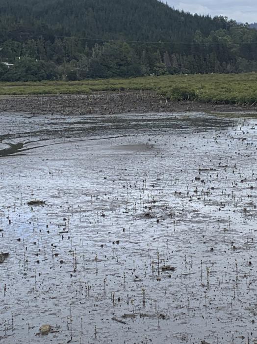 Library: Moanu Anu Anu sediment Folder 20070600 Environment Waikato draftwhangamataharbourplan 20061121 Environment Waikato draftwhangamatacatchmentmanagementplan 20180000 TCDC Coastal management plan 20170531 Climate Change stocktake 1 20180400 mfe Climate Change working group 2 20230100 draft Waikato Regional Coastal Plan 20220218 TCDC Coastal report-feasibility-study_summary-_rev-3-1 2008 Environment Waikato RC Mangrove removal assessment report 2019 WRC sedimentation measurements Waikato region TR201908 2009 Environment Waikato RC Whangamata Harbour Catchment Management Plans 2023 NIWA sea level rise actuals since 1900 2021 Draft Reserves Management Plan for Community Board track change and endorsement 2011 Hicks etal Suspended Sediment Yields from NZ rivers 2008 Environment Waikato Coastal sedimentation knowledge EWTR2008_12 2012 Surfbreak Protection Society The Whangamata Bar Dredging of Moanu anu anu adverse effects 2007 Environment Waikato Regional Council Whangamata overview 2006 Environment Waikato best practice Land Drainage tr06-06 2011 Waikato Regional Council Overview River and Catchment Services Waikato Region 2003 NIWA Hydrology Sediment Yield Estimate a GIS Tool 2001 Environment Waikato Technical Report Whangamata Harbour Contaminant Loads and Estuarine and Coastal Water Quality-1 2007 Environment Waikato technical Catchment Environmental Monitoring Report TR08-28 2007 Environment Waikato Annual Report 2007 - section 1 2017 Master's Thesis Nicky Glenjarman University of Canturbury Sediments effects on freshwater biota 2009 Environment Waikato Whangamata Harbour Catchment Management Plans Summary Document 2016 NIWA Sediment Attributes Stage 1 for Ministry for the Environment 2001 Environmant Waikato 16.11 report WRC Contaminants Loads and Water Quality-1 2014 WRC Sediment-Retention-Pond-fact-sheet 2000 EWDOCS-#583155-v1-Whangamata_Harbour_water_quality_investi– - TR00-02 2021 Auckland Council GD07 Soakage and Groundwater Recharge Guide 2020 Wiakato Regional Stormwater Policy TR20-07 2009 Otahu Shellfish survey Singleton TR201136 2013 NIWA Client report Intertidal estuaries Townsend - TR201352 2017 NIWA Client report Whangamata estuaries Townsend - TR201737 Auditor General 'The Office' OAG Folder 2018 OAG TCDC Managing stormwater systems to reduce the risk of flooding 2018 OAG review of TCDC stormwater systems+2others Logo
 WRA Ratepayers and Residents SURVEY RESULTS 2023-2024 Folder WRA PRESENTATION SURVEY 301023 Final WRA Ratepayers and Residents SURVEY RESULTS 2023-2024 WRC Coastal Management Plan 2025 Ian Holyoake submissions Folder 20231114 Coastal Plan submission Ian Holyoake attachment 2007 13 Draft Whangamata Catchment Plan EW 20250303 Ian Holyoake water quality presentation CMP 4 March 20250401 Ian Holyoake comments s42a depositionvF 20250401 Ian Holyoake Deposition SubmissionvF Moanu Anu Anu images Folder 2023
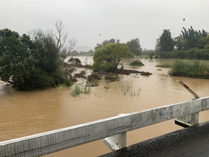 2023
2023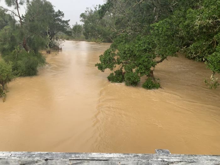 2023
2023 113 Truck bridge under flood conditions 2023
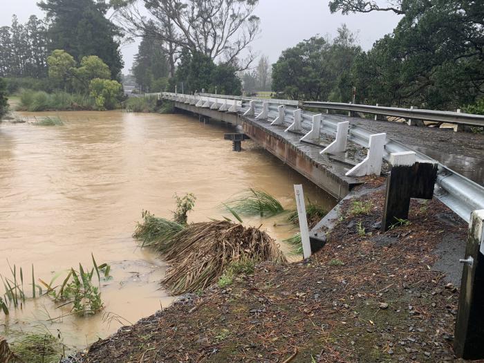 2023
2023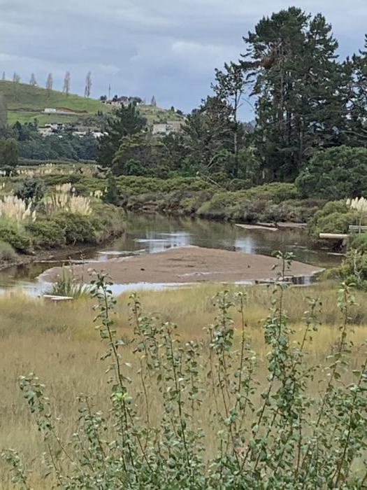 2023
2023 2023
2023 2023
2023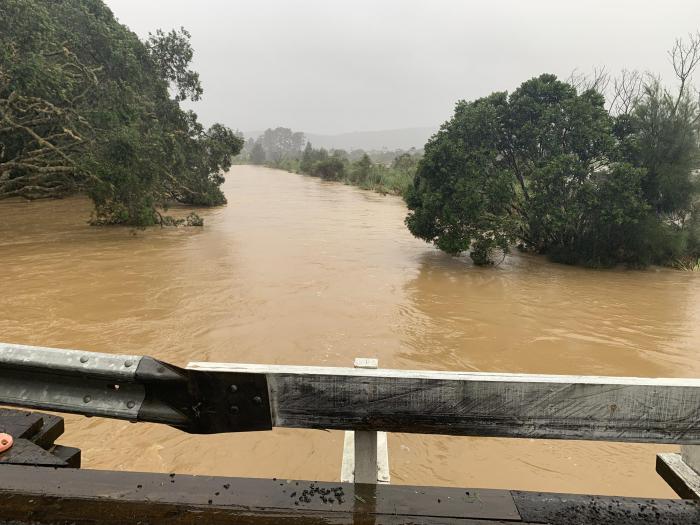 2023
2023 2023
2023 2023
2023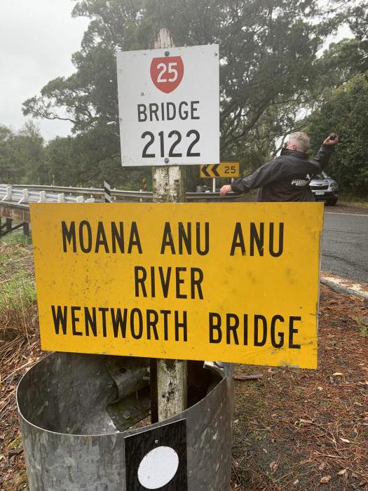 2023
2023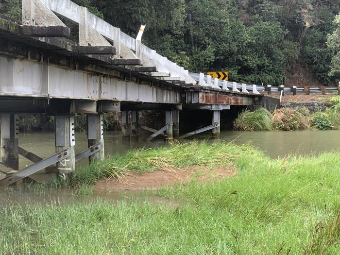 2023
2023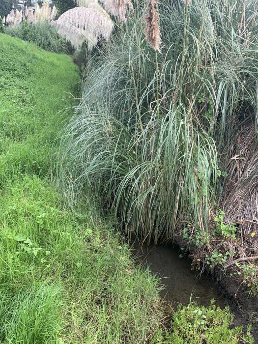 2023
2023 2023
2023 2023
2023 2023
2023 2023
2023 2023
2023 2023
2023 2023
2023 2023
2023 2023
2023 2023
2023 2023
2023 2023
2023 22E69100-8335-4E9A-9CBF-A94FA5D787ED
 2023
2023 2020
2020 1944
1944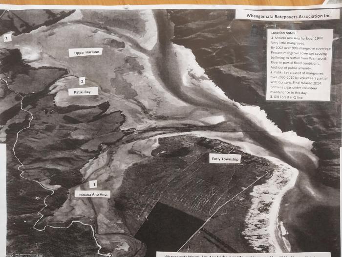 1944
1944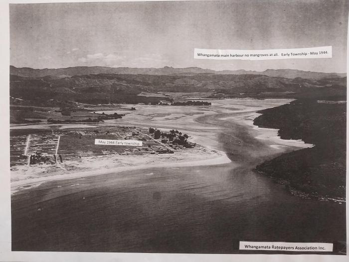 1944
1944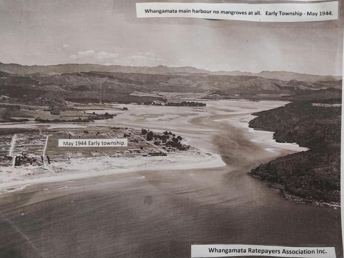 1944
1944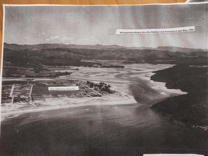 2012 I think
 2020
2020 2020
2020 2020
2020 1972
1972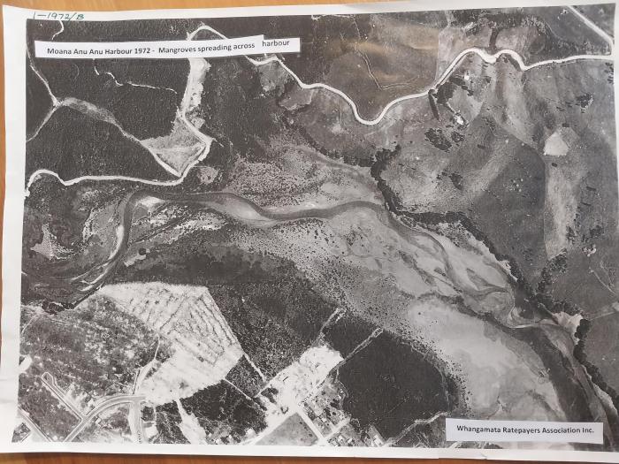 2012
2012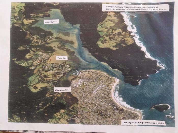 1944
1944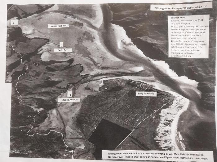 2020
2020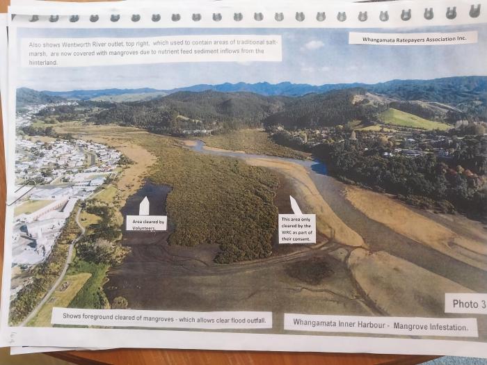 2012
2012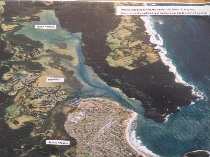 2012
2012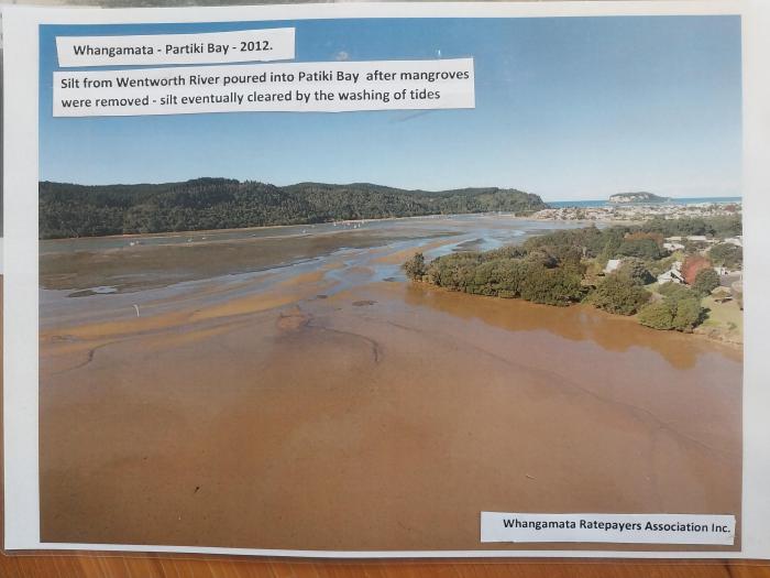 1944
1944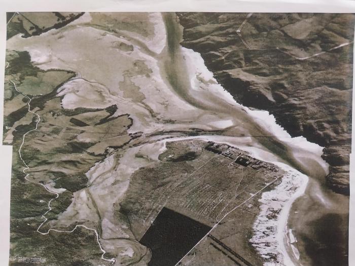 2012
2012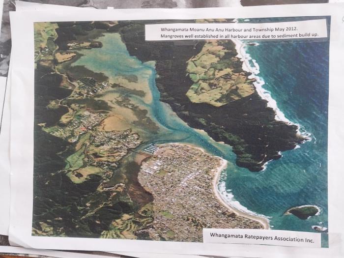 2002
2002 1944
1944 1980 I think
 1944
1944 1953 Moana and Harbour
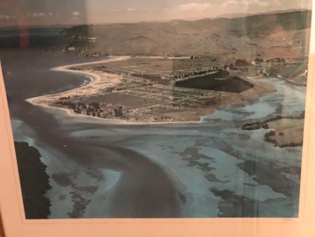 2012 I think MoanuAnuAnu grasses undatedIMG_2318
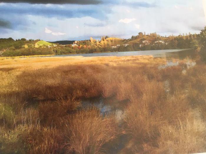 2012 I think MoanuAnuAnu Salt marsh mangroves undated
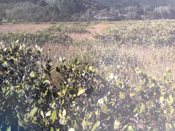 20250401 WRC RCP Ian Holyoake photos presentation 2 20250401 WRC RCP Ian Holyoake photo presentation 2 20250416 30 Ian Holyoake late submission GPT TCDC Historical Annual and Long Term Plans Folder 2023-2024 TCDC annual-plan-consult-2023_web 2015 to 2025 LTP consultation 2020 2021 TCDC Annual Plan 2009-2019 TCDC LTCCP Vol 1 2020_2021 Annual Plan - ap-2020 2006-2016 TCDC LTCCP Vol 2 2017_2018 Annual Plan - tcdc_annual_plan_2017-18_final 2016-2017 final-thames-coromandel-district-council annual-plan 2004-2014 TCDC LTCCP Vol 1 2019_2020 Annual Plan - ap-2019-22 2018 2028 TCDC LTP 2006-2016 TCDC 2006 LTCCP Vol 1 2012-2022 Long Term Plan website TCDC 2019 2020 TCDC Annual Report 2021-2031 TCDC Long Term Plan LTP 6.4 Million stormwater Whangamata 2022 2023 TCDC Annual Plan 2019 2020 TCDC Annual Plan 2023-2024 TCDC Annual Plan 2023_24 Stormy weather impacts roading and rates 2004-2014 TCDC LTCCP Vol 2 2018 to 2028 Annual Plan submission choices Wentworth Valley included 2018 2019 TDCD Annual Report Summary 2017 2018 TCDC Annual Plan 2023 websit re annual plan 2023_2024 TCDC 2015-2025 TCDC Long Term Plan 2017_2018 Annual Report - annual-report-2017-18 2015 TCDC Stormwater Asset Management Plan 2015 Draft Dec 2014 2016 2017 TCDC Annual Plan 2018-28 Long Term TCDC final-amended-11-december-2018 2022-2023 TCDC annual-plan-web 2023-2024 TCDC annual-plan-document-2023-web-final 2018 2019 TCDC Annual Report 2015 to 2025 TCDC LTP Consultation Document Whangamata p42 2021-2031 TCDC Long Term Plan LTP full document 2024-2034 Long Term Plan ltp24-document-final-july-1 Whangamata (South Eastern Ward) meet the candidates 27 September 2025 Folder
.jpg)